


 | Today's Date:





Cyclone Murasu Batters Andhra Coast With 120 kmph Winds and Flooding
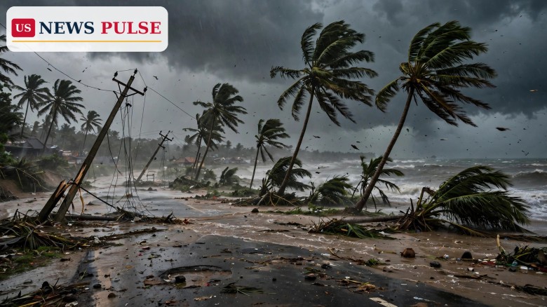
Cyclone Murasu made landfall on India's eastern coast early on Tuesday, November 3, 2026, battering Andhra Pradesh with gale-force winds, torrential rain and flooding that uprooted trees, toppled power poles, damaged crops and forced thousands of people into relief camps. The severe cyclonic storm crossed the south Andhra Pradesh coast near Ongole, in Prakasam district, between 3:30 a.m. and 5:30 a.m. local time, with sustained winds of 100 to 110 kilometres per hour gusting to 120 kmph, according to the India Meteorological Department (IMD).
No deaths or injuries had been reported by Tuesday morning, officials said, after a large evacuation effort moved people away from the most exposed coastal areas. The storm is the second cyclone to strike the region in less than a week, following Cyclone Arnab, and it disrupted transport, flights and power supplies across several districts while bringing heavy rain to neighbouring Tamil Nadu and Puducherry.
Key Points
- Severe Cyclonic Storm Murasu crossed the south Andhra Pradesh coast near Ongole between 3:30 a.m. and 5:30 a.m. on Tuesday, November 3, with winds of 100-110 kmph gusting to 120 kmph.
- The IMD said the storm would weaken into a cyclonic storm by Tuesday afternoon and into a deep depression by midnight, but warned of heavy to very heavy rain for hours after landfall.
- Preliminary assessments put crop damage at 30,661 hectares across 15 districts, with paddy, cotton and maize among the worst-hit crops.
- Authorities moved 10,805 people to 171 relief camps, distributed 14,810 food packets, and deployed 11 National Disaster Response Force teams and 13 State Disaster Response Force teams.
- No deaths or injuries had been reported by Tuesday morning, according to Andhra Pradesh disaster management officials, though damage surveys were still under way.
What Happened
The landfall process began at about 1 a.m. on Tuesday, when the forward sector of the storm's wall cloud reached the coast. Over the next few hours the centre crossed between Nellore and Narsapur, close to Ongole, moving north-northwest at about 8 kmph. At 5:30 a.m. it lay centred over south coastal Andhra Pradesh, about 40 kilometres southwest of Bapatla, 80 kilometres north-northeast of Kavali and 120 kilometres west-southwest of Machilipatnam.
As the storm came ashore, winds tore through coastal towns and villages. Thousands of trees were uprooted, hundreds of electricity poles were damaged, fishing boats were wrecked and standing crops suffered extensive losses, the Press Trust of India reported. A wind speed of 107 kmph was recorded near Dornala in Markapuram district. Continuous rain inundated low-lying areas, and the IMD forecast a storm surge of about 1 to 1.5 metres above the astronomical tide, likely to flood low-lying parts of south coastal Andhra Pradesh until Tuesday morning, with the highest surge expected over Bapatla, Krishna and Prakasam districts.
Transport was hit hard. At least 19 domestic flights were cancelled at Vijayawada, Tirupati and Visakhapatnam airports, and Chennai reported 11 flight cancellations, 237 complaints of water stagnation and 7.6 centimetres of rain by Monday. Schools in Chennai were closed on Tuesday, and the IMD issued an orange alert for the city. Red warnings were in force for Krishna, Guntur, Bapatla, Palnadu, NTR and Prakasam districts, with heavy rain and thunderstorms forecast at isolated places.
Background: A Second Storm in a Week
Murasu formed as a deep depression over the west-central Bay of Bengal on Sunday, November 1, and strengthened as it moved towards the Andhra coast. The IMD had earlier forecast that it could intensify into a very severe cyclonic storm before crossing the coast, a warning that prompted precautionary evacuations on Monday. Authorities had planned to move about 30,000 people to safety in Andhra Pradesh, and the final count of people in relief camps on Tuesday morning reflected the phased, district-by-district nature of that operation.
Cyclone Murasu Landfall: Damage Across 15 Districts
The early damage picture is dominated by agriculture. Krishna, Bapatla and Nandyal districts reported the highest crop losses, and officials said paddy, cotton and maize were among the worst-affected crops. The figure of 30,661 hectares across 15 districts is a preliminary assessment and is likely to change as field surveys reach villages cut off by waterlogging and fallen trees.
Beyond the fields, the storm's footprint stretched across the coastal belt. Prakasam and Bapatla districts reported extensive damage to trees, power poles and boats, while heavy rain was reported in Puducherry and northern Tamil Nadu. Fishermen along the Andhra Pradesh and northern Tamil Nadu coasts were urged to stay ashore until conditions normalised, and offshore operations were advised to remain suspended.
Reactions and Quotes
Prakhar Jain, managing director of the Andhra Pradesh State Disaster Management Authority, told Reuters that no deaths or injuries had been reported so far, a statement carried widely in Tuesday morning coverage. Indian Home Minister Amit Shah said on X that he had spoken to Andhra Pradesh Chief Minister N. Chandrababu Naidu about the cyclone's impact, signalling central government attention to the relief effort.
Why It Matters
Murasu matters first as a human story: tens of thousands of people spent the night in relief camps, farmers face a second round of crop losses in a week, and coastal communities must clear debris, restore power and drain waterlogged fields. It matters second as a test of early warning. The evacuation, the red and orange alerts and the pre-positioned rescue teams appear to have kept the casualty count at zero in the first hours, even as the physical damage mounted.
What Happens Next
The IMD expects Murasu to weaken into a cyclonic storm with winds of 80 to 90 kmph by Tuesday afternoon and into a deep depression, with winds of 55 to 65 kmph gusting to 75 kmph, by midnight. Heavy rain is still likely across south coastal Andhra Pradesh for the next 12 hours, and further heavy spells are forecast for parts of Tamil Nadu and Puducherry.
Relief and repair will follow the rain. Damage teams will complete crop and infrastructure surveys, power crews will restore lines, and officials will decide when evacuated families can safely return home. Any update on casualties, a revised crop-loss figure or an extended rain warning would be the next significant development.
Frequently Asked Questions
Where did Cyclone Murasu make landfall? Near Ongole in Prakasam district, on the south Andhra Pradesh coast, between Nellore and Narsapur, between 3:30 a.m. and 5:30 a.m. on Tuesday, November 3, 2026.
How strong were the winds? Sustained winds of 100 to 110 kmph, gusting to 120 kmph, according to the IMD. A gust of 107 kmph was recorded near Dornala in Markapuram district.
Was anyone killed or injured? No deaths or injuries had been reported by Tuesday morning, according to Andhra Pradesh disaster management officials.
How many people were evacuated? Authorities moved 10,805 people to 171 relief camps and distributed 14,810 food packets, with 11 NDRF and 13 SDRF teams deployed.
What happens to the storm next? The IMD expects it to weaken into a cyclonic storm by Tuesday afternoon and into a deep depression by midnight, with heavy rain continuing for hours after landfall.
Read more: Typhoon In-Fa warning: Category 4 storm nears Northern Mariana Islands, King tides flood US coasts.
Leave a Comment