
Apple Maps Blurs US Military Bases and Space Sites in Quiet Security Change
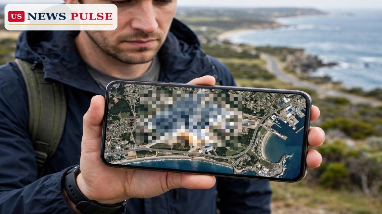
Apple Maps has quietly begun blurring satellite imagery over some of America's most sensitive military and space sites, hiding launch pads, tarmacs and bomber bases from anyone zooming in on a phone. The Apple Maps military bases change, spotted and reported on October 30 and 31, 2026, covers Cape Canaveral Space Force Station in Florida, Vandenberg Space Force Base in California and Whiteman Air Force Base in Missouri, among others, and Apple has said nothing about it publicly.
Key Points
- Apple Maps now blurs satellite views of Cape Canaveral, Vandenberg, Wallops Flight Facility, Stennis Space Center, Whiteman and Ellsworth Air Force Bases, Groom Lake (Area 51) and Los Alamos National Laboratory.
- Apple has made no announcement about the change, and no timeline or criteria for future blurring has been disclosed.
- Google Maps has not blurred any of these locations, so the same sites remain clearly visible on Google's service.
- Not every base is blurred: Kennedy Space Center's historic LC-39A and LC-39B pads, Pearl Harbor, Norfolk and Naval Station Great Lakes remain clear, as do Dyess and Barksdale Air Force Bases.
- Fort Sill in Oklahoma was also found blurred in a separate October 30 local report, while its Google Maps view stays fully labelled and clear.
What Happened
The discovery was reported by Space Explored on October 31, 2026, after its writers checked Apple Maps and found that a string of NASA and US Space Force locations were newly pixelated. "A recent change to Apple Maps now has some of those locations blurred from view, blocking anyone from seeing fighters on tarmacs or rockets on launch pads," the report said. It added that the change "looks to have been rather recent, with no announcement by Apple for the change."
The blurred list is long, and it is oddly specific. On the space side, it includes Wallops Flight Facility in Virginia, Stennis Space Center in Mississippi, Cape Canaveral Space Force Station in Florida and Vandenberg Space Force Base in California, plus Patrick Space Force Base, Cape Canaveral's parent base. On the military side, it includes Whiteman Air Force Base, home to the bulk of the Air Force's B-2 stealth bombers, and Ellsworth Air Force Base, one of two stateside homes of the B-1B bomber. It also includes Groom Lake, better known as Area 51, and the Los Alamos National Laboratory.
A separate local report from KLAW in Lawton, Oklahoma, published October 30, found the same treatment at Fort Sill, near Lawton. Its author checked Apple Maps on the web after seeing a social-media post about the blurring and confirmed: "You can clearly see Lawton if you're familiar with what you're looking at, and yep, Fort Sill is clearly blurred." The same report noted that Google Maps, by contrast, "clearly labels everything."
Background and Context
Map services have long walked a line between public information and operational security. Satellite imagery of military installations has been freely available for years on commercial services, and enthusiasts, journalists and researchers routinely use it to track construction, deployments and launches. Blurring is not new in principle: governments have asked imagery providers to obscure sensitive sites before, and some locations around the world have long been pixelated on one service or another.
What makes this episode notable is the selectivity, and the silence. Apple has not explained why these sites were chosen, who asked for the change, or whether more sites will follow. Space Explored noted that the rollout appears incomplete and inconsistent: Wallops Flight Facility's airfield is blurred, but its launch pads along the coast are not. Kennedy Space Center and its historic LC-39A and LC-39B pads, the launch site of Apollo missions and today's crewed SpaceX flights, are not blurred at all.
The inconsistency extends to the bomber fleet. Whiteman, home to most B-2 stealth bombers capable of carrying nuclear weapons, is blurred, and Ellsworth, a B-1B home, is blurred too. But Dyess Air Force Base, the second B-1B home, and Barksdale, home to the vast majority of the B-52 fleet, are not blurred, according to the same report. Large Navy installations, including Pearl Harbor, Norfolk and Naval Station Great Lakes, are also left clear, as are the two Air National Guard bases checked by the Wisconsin-based author.
Apple Maps Blurs Military Bases: What Is Blurred and What Is Not
The clearest way to understand the change is as two lists. Blurred, according to the reports read for this article: Cape Canaveral Space Force Station, Vandenberg Space Force Base, Patrick Space Force Base, Wallops Flight Facility's airfield, Stennis Space Center, Whiteman Air Force Base, Ellsworth Air Force Base, Fort Sill, Groom Lake (Area 51) and Los Alamos National Laboratory. Not blurred: Kennedy Space Center's LC-39A and LC-39B, Wallops' launch pads, Dyess and Barksdale Air Force Bases, Pearl Harbor, Norfolk, Naval Station Great Lakes, and the Wisconsin Air National Guard bases checked.
That patchwork matters because it limits what the blurring actually achieves. Anyone who wants a clear satellite view of a blurred base can still open Google Maps, which has not blurred any of these locations, or turn to other commercial imagery sources. As the KeepTrack space briefing put it on October 31, for launch watchers "Apple is now a dead end for pad imagery at both US coastal spaceports," but "other commercial imagery sources still show the same ground, so this mostly changes which app you use to check a pad."
It also raises a practical question the reports flag directly: navigation. Space Explored asked how on-base navigation works on blurred installations, and whether Apple CarPlay still functions there, or whether military personnel and civilians working at these bases will need another service for on-base directions. Apple has not answered those questions, because it has not commented at all.
Reactions and Quotes
Apple has issued no statement on the change in the reports read for this article, and no explanation has been offered for the timing, the selection of sites or the rollout plan. The reaction so far has therefore come from the people who noticed it, and it is a mix of understanding and scepticism.
Space Explored framed the security case sympathetically: "It probably makes sense as a reasonable security measure, why should some of the most sensitive locations to the United States be easily seen from commercial services on anyone's phone?" But it also flagged the open questions: "Without a formal announcement from Apple, we aren't sure how quickly the company plans to blur over future bases; and if it's just highly sensitive facilities or if all government locations are on the list to be blurred."
The KLAW report was more sceptical, asking why Apple alone would hide sites that every other service shows in full. "If every other infinitely more reliable mapping site out there is still giving our military installations the Full Monte treatment, what's up with Apple?" it asked, before conceding that most people would at least understand why a military installation might prefer secrecy, while noting that the secrecy achieves little if the same view is available elsewhere.
Why It Matters
The change matters for three reasons. First, it signals a shift in how at least one major consumer platform treats sensitive US sites, at a moment when space and defence infrastructure is more watched than ever: Cape Canaveral and Vandenberg are the country's two coastal spaceports, and Vandenberg hosted SpaceX's 700th Falcon 9 launch just hours before the blurring was reported. Second, it shows how uneven such measures can be when they are rolled out without explanation: a blur that covers one bomber base but not another, or one spaceport's airfield but not its pads, invites questions about the criteria behind it. Third, it is a reminder that consumer maps are now part of the security conversation, not just a convenience: what a phone shows, and what it hides, is a policy choice, even when the company making it says nothing.
For ordinary users, the immediate effect is small. Navigation, directions and place search are unaffected in the reports; only the satellite imagery layer over specific sites is obscured. For researchers, journalists and open-source analysts, the effect is larger but not decisive: Google Maps and other imagery providers still show the same ground, so the work moves to another app rather than stopping.
What Happens Next
Three things are worth watching. The first is whether Apple comments or expands the list: Space Explored presumed Apple will continue to roll out blurred changes to more bases, but without an announcement, the pace and scope are unknown. The second is whether Google follows: so far it has not blurred any of these sites, and any change there would be a much bigger shift, because Google Maps is the default imagery source for most researchers. The third is whether the blurring spreads beyond the sites already found, including to the currently clear pads at Kennedy Space Center and Wallops, or to the Navy installations still visible.
Until Apple speaks, the story remains a spotted change rather than an explained policy. What is confirmed is the fact of it: open Apple Maps today, zoom in on Cape Canaveral, Vandenberg, Whiteman or Fort Sill, and the satellite view is blurred. Open Google Maps, and it is not.
Frequently Asked Questions
Has Apple Maps blurred US military bases?
Yes, according to reports published October 30-31, 2026. Satellite imagery on Apple Maps is now blurred over Cape Canaveral, Vandenberg, Whiteman, Ellsworth, Fort Sill, Wallops airfield, Stennis, Groom Lake (Area 51) and Los Alamos, among others.
Why is Apple blurring these bases?
Apple has not said. The reports presume a security measure, but there has been no announcement, no stated criteria and no timeline for further sites.
Has Google Maps blurred the same bases?
No. Google Maps has not blurred any of these military locations, and the same sites remain clearly visible and labelled there.
Are all US bases blurred on Apple Maps?
No. Kennedy Space Center's LC-39A and LC-39B pads, Pearl Harbor, Norfolk, Naval Station Great Lakes, Dyess and Barksdale Air Force Bases remain clear on Apple Maps in the reports checked.
Does the blurring affect navigation?
The reports do not say navigation is affected; only the satellite imagery layer is blurred. Whether CarPlay and on-base directions work normally on blurred bases is an open question the reports raise.
Related coverage on US News Pulse: SpaceX Falcon 9 700th launch caps October with 27 new Starlink satellites and xAI Mississippi homes buyout: Musk firm targets 418 houses over noise lawsuit.
© 2026 US News Pulse. All rights reserved.
 Print
 Save