
Nor'easter Tornado Warning at JFK Airport as Tornadoes Strike Delaware and New Jersey
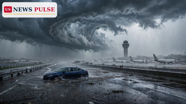
The nor'easter tornado warning at John F. Kennedy International Airport on Thursday, November 12, 2026, capped a rare mid-November severe-weather outbreak across the Northeast and Mid-Atlantic. The National Weather Service issued the warning for Queens at 1:14 p.m. Eastern Time after radar showed rotation in a severe thunderstorm sweeping over Rockaway Beach toward JFK, and confirmed tornadoes touched down in Delaware and New Jersey while flash flooding swamped roads from Pennsylvania to Long Island. The storm dumped just over 3.32 inches of rain on JFK, its second-wettest November day on record, and no tornado touched down on land in New York City.
Key Points
- National Weather Service tornado warning for Queens, 1:14 p.m. ET Thursday, November 12, 2026: radar-indicated rotation in a severe thunderstorm moving from Rockaway Beach toward JFK Airport; the warning covered southern Queens, including JFK, and southwestern Nassau County until 2 p.m. ET.
- No tornado touchdown on land in New York City was reported; video showed a wall cloud lowering near JFK Airport as the storm passed.
- A tornado was confirmed in New Castle County, Delaware, near Wilmington, only the second November tornado in Delaware since records began in 1950, with damage reported around Christiana Hospital. A second tornado was confirmed in Burlington County, New Jersey.
- JFK Airport recorded just over 3.32 inches of rain, its second-wettest November day on record, while Central Park saw more than 1.6 inches. Hail battered Queens, including Far Rockaway, and quarter-sized hail fell in New Jersey.
- Thunderstorm ground stops were put in place at JFK and LaGuardia airports, with JFK departure delays of 16 to 30 minutes and rising. Heavy rain and flash flooding closed parts of the JFK Expressway, stranded at least one vehicle, and forced water rescues in Aston and Chester Township, Pennsylvania.
What Happened
A powerful nor'easter swept up the East Coast, dragging warm, moist air north ahead of a cold front and setting off severe thunderstorms across the Northeast and Mid-Atlantic on Thursday afternoon. The most dangerous cell formed over the Atlantic coast of Queens, where radar picked up rotation near Rockaway Beach, and forecasters urged people in southern Queens and southwestern Nassau County to take shelter as the storm moved northeast at about 15 mph toward JFK. The warning lasted less than an hour, expiring at 2 p.m. ET as the storm weakened. Elsewhere the storms did produce tornadoes, in New Castle County, Delaware, and Burlington County, New Jersey, while flash flooding triggered water rescues in Aston and Chester Township, Pennsylvania, and snow fell in the Adirondacks of upstate New York.
Background: A Rare November Outbreak
November tornadoes are uncommon in the Northeast, where the ingredients for rotating thunderstorms usually fade with the autumn: warm, humid air near the ground, strong wind shear and a lifting mechanism must all line up, and by mid-November the Atlantic coastal waters have normally cooled too much. The nor'easter supplied the missing pieces, pulling in warm air ahead of it while a sharp cold front provided the lift. The storm was also a heavy rainmaker, and the same system had been watched for days: earlier in the week, forecasters warned that a nor'easter would bring the first snow and a deep freeze to much of the eastern United States, and the storm's severe side arrived before its cold side did.
Nor'easter Tornado Warning: The Storm Over JFK Airport
For travellers, the warning meant delays and disruption at the worst possible moment. Both JFK and LaGuardia were placed under thunderstorm ground stops, halting departures while the storms passed overhead; at JFK, departure delays built to between 16 and 30 minutes and were still rising as the warning expired, and arriving aircraft faced holding patterns and diversions. On the ground, the flooding was the bigger problem: heavy rain and flash flooding closed parts of the JFK Expressway, with traffic diverted around the water and at least one vehicle stuck in floodwater, while hail battered Queens, including Far Rockaway.
Reactions and Official Guidance
The National Weather Service based its warning on radar-indicated rotation moving northeast at about 15 mph, a signature forecasters treat as a tornado threat even when no funnel has been seen on the ground, and let the warning expire at 2 p.m. ET once the storm weakened. The Federal Aviation Administration's ground stops kept aircraft on the ground while the worst weather passed, and airport staff worked to clear standing water. In Pennsylvania, emergency crews carried out water rescues in Aston and Chester Township, and local officials urged drivers not to attempt flooded roads. No injuries were reported in connection with the New York City warning.
Why It Matters
The outbreak broke the usual seasonal rules. A November tornado in Delaware is rare enough on its own: only one other has been recorded in the month since 1950. A tornado warning over JFK Airport, one of the busiest international gateways in the United States, is rarer still. It arrived on a day when the same storm was flooding expressways, hailing on Queens and forcing water rescues in Pennsylvania, a reminder that severe weather does not keep to the calendar. The storm also showed how quickly a single cell can disrupt air travel at two major airports, and how little warning time residents may have when rotation appears on radar.
What Happens Next
Rain was expected to continue into Friday, with colder air and gusty northwest winds behind the storm, and snow continued in the Adirondacks. The National Weather Service was expected to survey the damage in New Castle County, Delaware, and Burlington County, New Jersey, to confirm the strength and paths of the two tornadoes. For travellers, the advice is to check flight status before heading to the airport; for drivers, the standing warning applies: never drive through flooded roads, where a few inches of moving water can stall a car and a foot can carry it away.
Frequently Asked Questions
Did a tornado touch down at JFK Airport?
No. Radar showed rotation in a severe thunderstorm moving toward JFK, and video showed a wall cloud near the airport, but no tornado touchdown on land in New York City was reported.
Where were tornadoes confirmed?
Two: one in New Castle County, Delaware, near Wilmington, and one in Burlington County, New Jersey. The Delaware tornado was only the second November tornado in the state since records began in 1950.
How much rain fell at JFK Airport?
Just over 3.32 inches, JFK's second-wettest November day on record. Central Park recorded more than 1.6 inches.
Were flights affected?
Yes. Thunderstorm ground stops were put in place at JFK and LaGuardia, and JFK departure delays reached 16 to 30 minutes and were still rising when the warning expired.
Is more severe weather coming?
Rain was expected to continue into Friday, followed by colder air and gusty northwest winds, with snow in the Adirondacks. Forecasters said the storm would weaken as it moved away from the coast.
Related coverage: Nor'easter to bring first snow and deep freeze to 200 million in eastern US; Arizona flash floods, rescues and one death as Southwest braces for more rain; Two dead as 1,000-year flooding swamps Palm Bay, Florida, hundreds rescued.
© 2026 US News Pulse. All rights reserved.
 Print
 Save