
Magnitude 5.1 Earthquake Strikes Near Soledad, California, Felt in San Francisco
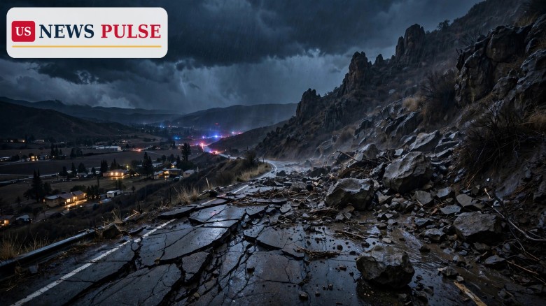
A magnitude 5.1 earthquake struck near Soledad in California's Monterey County late on Thursday, November 19, 2026, shaking homes across the region and sending tremors as far away as San Francisco, the US Geological Survey said.
The quake hit at 10:49 p.m. local time, at a shallow depth of 6.7 kilometres (4.2 miles), with its epicentre about 10 kilometres northwest of Pinnacles National Park, roughly 20 to 21 kilometres north-northeast of Soledad and about 40 kilometres from Salinas, a city of about 157,000 people. The USGS first reported the quake as magnitude 5.4 before downgrading it to 5.1.
Around 17,000 people experienced moderate shaking and about 2.5 million people felt weak shaking, according to the USGS. The agency's ShakeAlert early-warning system was activated, sending residents "drop, cover, hold on" alerts on their phones. No injuries or major damage had been reported, no tsunami warning was issued, and the USGS found no evidence of landslides or soil liquefaction.
Key Points
- A magnitude 5.1 earthquake struck near Soledad in Monterey County, California, at 10:49 p.m. local time on Thursday, November 19, 2026, the USGS said.
- The USGS first reported the quake as magnitude 5.4, then downgraded it to 5.1, at a depth of 6.7 kilometres (4.2 miles), with the epicentre about 10 kilometres northwest of Pinnacles National Park.
- Shaking was felt as far away as San Francisco, with around 17,000 people experiencing moderate shaking and about 2.5 million feeling weak shaking.
- The USGS ShakeAlert early-warning system was activated, sending residents "drop, cover, hold on" alerts; no injuries or major damage had been reported.
- Foreshocks of magnitude 3.1 and 3.3 came first, and a magnitude 3.0 aftershock followed minutes later, plus further tremors including a magnitude 3.4.
What Happened
The evening began with warning signs. A magnitude 3.1 foreshock struck at 9:53 p.m., followed by a magnitude 3.3 tremor at 10:12 p.m., less than an hour before the main quake. Then, at 10:49 p.m., the magnitude 5.1 earthquake hit near Soledad, rattling homes and businesses across Monterey County and well beyond it.
The shaking spread widely, reaching San Francisco, and emergency services in Monterey County checked for damage through the night. Minutes after the main quake, a magnitude 3.0 aftershock struck, with further tremors including a magnitude 3.4. No injuries or major damage had been reported, and the USGS found no evidence of landslides or soil liquefaction.
Background: The San Andreas Fault and Pinnacles
The quake struck in a part of California that sits on one of the most closely watched fault systems in the world. Experts cited by the San Francisco Chronicle said the earthquake happened along the San Andreas Fault, the boundary between the Pacific and North American tectonic plates.
The epicentre lay about 10 kilometres northwest of Pinnacles National Park, a rugged landscape of rock formations in the Gabilan Mountains, and roughly 20 to 21 kilometres north-northeast of Soledad, a small city in the Salinas Valley. Salinas, the largest city in the area with about 157,000 people, sits about 40 kilometres away.
Magnitude 5.1 Earthquake: What the USGS Measured
The numbers tell the story of a moderate but widely felt quake. At magnitude 5.1 and a depth of 6.7 kilometres, the earthquake was shallow enough for its energy to reach the surface strongly, which is why it was felt so far away, including in San Francisco.
The two foreshocks came in the hour before the main event, and the aftershocks, including the magnitude 3.0 minutes later and a magnitude 3.4, The USGS put the chance of a magnitude 3.0 or stronger aftershock within a week at 66 percent, a magnitude 4.0 or stronger at 17 percent, and a magnitude 5.0 or stronger at 2 percent.
Reactions and Quotes
The clearest official guidance of the night came from the ShakeAlert system itself, which sent residents the three-word instruction that earthquake safety experts repeat everywhere: "drop, cover, hold on." The alert gives people seconds to protect themselves before the strongest shaking arrives.
The USGS, which reported the quake within minutes, provided the measurements that shaped the night: the downgrade from 5.4 to 5.1, the depth of 6.7 kilometres, the epicentre near Pinnacles National Park, and the shaking estimates. Its finding of no evidence of landslides or liquefaction, and the absence of a tsunami warning, set the tone for the official response.
Why It Matters
It matters first because of where it happened. The San Andreas Fault is the fault Californians are taught to respect from childhood, and a magnitude 5.1 on it, felt from Monterey County to San Francisco, is a reminder that the state's seismic risk is not theoretical. Quakes of this size can cause damage, and this one arrived in the middle of the night.
It matters second because of the warning system, and third because of the storm. ShakeAlert sent its "drop, cover, hold on" alerts across the region, giving the system another real-world test. And the earthquake struck during a major atmospheric river already bringing flooding rain, power outages and downed trees, a combination of saturated ground, high water and shaking that worries emergency managers.
What Happens Next
The USGS will keep monitoring the aftershock sequence, and residents should expect more tremors. The agency puts the chance of a magnitude 3.0 or stronger aftershock within a week at 66 percent, so smaller shakes are likely, and a magnitude 4.0 or stronger carries a 17 percent chance.
Emergency officials in Monterey County and the Bay Area will continue their damage checks in daylight, looking for cracked walls, damaged chimneys and any problems on roads and bridges, particularly in the hills around Pinnacles National Park and along the highways of the Salinas Valley.
Frequently Asked Questions
How strong was the California earthquake?
The earthquake was magnitude 5.1, according to the USGS, which first reported it as magnitude 5.4 before downgrading it. It struck at a depth of 6.7 kilometres (4.2 miles).
Where was the earthquake centred?
The epicentre was about 10 kilometres northwest of Pinnacles National Park, roughly 20 to 21 kilometres north-northeast of Soledad in Monterey County, and about 40 kilometres from Salinas.
Was the shaking felt in San Francisco?
Yes. Shaking was felt as far away as San Francisco. Around 17,000 people experienced moderate shaking and about 2.5 million people felt weak shaking, according to the USGS.
Was there any damage or a tsunami warning?
No injuries or major damage had been reported, no tsunami warning was issued, and the USGS found no evidence of landslides or soil liquefaction.
Will there be aftershocks?
Almost certainly. The USGS puts the chance of a magnitude 3.0 or stronger aftershock within a week at 66 percent, a magnitude 4.0 or stronger at 17 percent, and a magnitude 5.0 or stronger at 2 percent. A magnitude 3.0 aftershock struck minutes later, followed by a magnitude 3.4.
Related coverage: LA County Evacuation Warnings as Storm Threatens Mudslides on Burn Scars, Florida Flooding: Okeechobee Schools Close as 5.7 Inches of Rain Swamp Lake Area, and DeSantis Declares Florida Flooding State of Emergency in 7 Counties.
© 2026 US News Pulse. All rights reserved.
 Print
 Save