
California Storm Waves Reach 30 Feet as Coastal Flooding Warnings Go Up
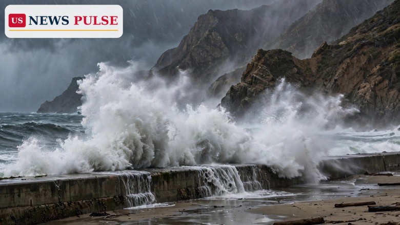
California is bracing for a series of powerful Pacific storms that will drive 30-foot waves onto the state's beaches this weekend, with forecasters warning of coastal flooding, dangerous rip currents and waves crashing over seawalls from San Francisco to Los Angeles. The National Weather Service says breaking waves of up to 30 feet (9 metres) are expected off San Francisco, southern Monterey Bay and the Big Sur coast from Friday evening, with occasional sets of 40 to 50 feet possible. Near Los Angeles, widespread rain that began on Friday will continue into Saturday, while a high surf advisory runs through Tuesday afternoon.
Key Points
- The National Weather Service warns of breaking waves of up to 30 feet off San Francisco, southern Monterey Bay and the Big Sur coast from Friday evening, with sets of 40 to 50 feet possible.
- "Large breaking waves will run up beaches and crash over seawalls, inundating adjacent, low-lying infrastructure," the National Weather Service warned.
- Near Los Angeles, widespread rain began on Friday and continues into Saturday, with surf of 7 to 12 feet and dangerous rip currents.
- A high surf advisory runs from 2 p.m. Friday through 3 p.m. Tuesday, with the greatest surf impact expected to peak on Saturday and possibly again on Monday.
- The storm series is driven by a strengthening El Niño pattern and follows weeks of coastal damage, including tropical-storm waves that wrecked parts of the Long Beach waterfront.
What Happened
The first storm in the series moved into California on Friday, November 14, 2026, opening a stretch of unsettled weather expected to last for days. In Southern California, widespread rain began falling on Friday and was set to continue into Saturday, soaking a coastline already battered in recent weeks. At the same time, a powerful swell began building far offshore, pushed ahead of the storms as they crossed the Pacific.
The National Weather Service issued warnings for the central and northern coast, where the surf will be at its most dangerous. Breaking waves of up to 30 feet are expected off San Francisco, southern Monterey Bay and the Big Sur coast from Friday evening, with occasional sets of 40 to 50 feet. Further south, near Los Angeles, waves of 7 to 12 feet are expected on Saturday, along with dangerous rip currents.
Background and Context
California's coast is no stranger to big winter surf, but this storm series arrives on top of weeks of damage. Earlier this autumn, tropical-storm waves destroyed sections of the Long Beach waterfront, flooded a residential neighbourhood and damaged homes now at risk of collapse. Beaches and seawalls already weakened now face another round of pounding surf, and low-lying coastal roads are again in the firing line.
The storms are being driven by a strengthening El Niño pattern, which warms the tropical Pacific and shifts storm tracks so more systems reach the California coast. A stronger El Niño typically means a wetter, stormier winter for the southern half of the state. The same pattern has already brought severe weather elsewhere in the West this week, dumping up to two feet of snow on the Sierra Nevada. For more, read our report on up to 24 inches of snow and 90 mph gusts in the Sierra.
California Storm Waves: 30-Foot Breakers and 50-Foot Sets
A 30-foot breaking wave is roughly the height of a three-storey building, and it carries far more power than its height alone suggests. When a wave of that size breaks, thousands of tonnes of water rush up the beach in seconds, and anything in its path, from driftwood to parked cars, can be swept along with it.
Waves travel in sets, groups of larger waves that follow smaller ones, and the biggest waves in a set can be far taller than the average. That is why forecasters warn of occasional sets of 40 to 50 feet even while the general forecast is for 30-foot surf. The danger is greatest where the coast is low and built up: water that overtops seawalls can flood roads and ground-floor rooms in minutes, while jetties, piers and rocks are the most dangerous places of all, because a single large wave can sweep people into the sea.
Reactions and Quotes
The National Weather Service has been blunt about the danger. "Large breaking waves will run up beaches and crash over seawalls, inundating adjacent, low-lying infrastructure," the agency warned. Forecasters urged people to stay out of the water and off jetties, piers and rocks, adding a warning beachgoers ignore at their peril: "NEVER turn your back on the ocean."
The message is aimed at everyone tempted to watch the spectacle up close. Big surf draws crowds, and the most dangerous moments often come when a large set arrives after a calm stretch. Officials say the safest place to watch is from well back, on high ground.
Why It Matters
This storm matters because it strikes a coastline already damaged and a state already dealing with a brutal week of weather. Homes near the shore in Long Beach were left at risk of collapse after tropical-storm waves earlier this autumn, and the same kind of surf is now returning. The combination of high surf, heavy rain and strong rip currents means even a short visit to the beach carries real risk this weekend. For how the same pattern is hitting the north-west, see our coverage of the atmospheric rivers slamming the Pacific Northwest.
What Happens Next
The greatest surf impact is expected to peak on Saturday, when the largest waves reach the central and northern coast and moderate coastal flooding is possible at times, especially around high tide. A second peak is possible on Monday as the next storm in the series moves in, and the high surf advisory runs until 3 p.m. on Tuesday. Rain will continue across Southern California into Saturday. Residents in flood-prone coastal areas should watch official updates, avoid flooded roads and never drive through standing water. For more on the coast's recent flooding, see our report on the record king tides that flooded California and Florida.
Frequently Asked Questions
How big will the waves be in California? Breaking waves of up to 30 feet are expected off San Francisco, southern Monterey Bay and Big Sur, with sets of 40 to 50 feet possible. Near Los Angeles, surf of 7 to 12 feet is expected on Saturday.
When will the surf be at its worst? The greatest impact is expected to peak on Saturday, with a possible second peak on Monday as the next storm arrives.
How long does the high surf advisory last? The advisory runs from 2 p.m. on Friday through 3 p.m. on Tuesday.
What is causing these storms? A strengthening El Niño pattern is warming the tropical Pacific and steering more storm systems towards the California coast.
Is it safe to visit the beach this weekend? No. Forecasters urge people to stay out of the water and off jetties, piers and rocks, and warn beachgoers never to turn their back on the ocean.
© 2026 US News Pulse. All rights reserved.
 Print
 Save