


 | Today's Date:





California Winter Storm Brings Up to 24 Inches of Snow and 90 Mph Gusts to the Sierra
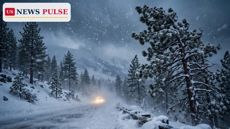
A powerful Pacific storm swept into California and Nevada on Friday, November 13, 2026, bringing the first major snowfall of the season to the Sierra Nevada. Winter storm warnings are in force across the mountains, with up to 24 inches of snow forecast for the highest peaks, ridge-top gusts reaching 90 mph and waves as high as 35 feet pounding the coast.
The National Weather Service issued warnings across both states as the storm arrived, the first in a series of Pacific systems bringing heavy mountain snow, strong winds, dangerous surf and rain.
Key Points
- Winter storm warnings are in force across California and Nevada as the first major Pacific storm of the season reached the Sierra.
- Up to 24 inches of snow is forecast for the highest Sierra peaks, with about 12 inches above 7,000 feet around Lake Tahoe.
- Ridge-top gusts could reach 70 to 90 mph, with gusts to 60 mph in the northern Sierra and 35 to 45 mph in Truckee and lakeside towns.
- High surf warnings cover the coast from Oregon to Big Sur, with waves as high as 35 feet.
- A second, colder system is due Sunday into Monday, with more mountain snow and valley rain.
What Happened
The storm pushed ashore Friday, and the National Weather Service posted winter storm warnings across the Sierra Nevada, wind advisories in the Sacramento Valley and high surf warnings along the Central Coast. The Sacramento office said the first storm “will be the stronger system in terms of winds and heavy snow.” A northern Sierra warning runs from 10 a.m. Friday to 10 a.m. Saturday above 6,000 feet, covering Interstate 80, U.S. Highway 50 and state routes 4 and 108.
The Sacramento office forecast 6 to 12 inches of snow above 6,000 feet, with up to 24 inches on the highest peaks. “Travel could be very difficult,” the warning said. “The hazardous conditions will impact the Friday evening commute.” Around Lake Tahoe, the heaviest snow was expected from 2 p.m. to 8 p.m. Friday, falling up to 3 inches an hour on the crest. In Southern California, heavy showers over the Eaton burn scar prompted flood advisories.
Background: A Dry Fall Before the First Big Storm
The storm arrives after a notably dry fall. San Jose had received only 0.27 inch of rain since September 1, just 22 percent of its historical average. Sacramento County officials said dry ground should absorb much of the early rain.
“If we end up seeing storm after storm after storm and the ground becomes saturated and can’t hold that water, then it’s time to become nervous,” county spokesperson Matt Robinson told CBS Sacramento.
The Sierra snowpack is California’s largest natural reservoir, and the dense, wet snow known as “Sierra cement” adds water fast but weighs down trees and power lines.
California Winter Storm: Warnings, Snow Totals and Wind
The Reno office’s warning for the Greater Lake Tahoe area runs 10 a.m. Friday to 10 a.m. Saturday, forecasting about 12 inches of heavy, wet snow above 7,000 feet and up to 20 inches along the crest west of the lake. Ridge-top gusts of 70 to 90 mph are expected, with 35 to 45 mph in Truckee and lakeside towns. Forecasters warned the wet snow and strong winds “could cause damage to trees and power lines.”
Farther south, the Hanford office warned Yosemite, Kings Canyon and Sequoia national parks of up to 20 inches of snow above 6,000 feet and gusts to 50 mph through Tuesday at 4 a.m. Along the coast, breaking waves of 18 to 25 feet are forecast for San Luis Obispo and Santa Barbara counties, with a high surf warning from 9 p.m. Friday to 3 a.m. Sunday.
Reactions and Warnings
Transport officials urged drivers to stay off mountain roads or be ready for chain controls and long delays. Caltrans said it had prepared for the storm, and Jeremy Linder of Caltrans District 3 told ABC10: “Our maintenance crews are prepped, they are ready to go.”
“You don’t know if it’s going to be 30 minutes or if it’s going to be several hours,” Linder said of Interstate 80 delays, noting the speed limit drops to 30 mph under chain controls.
Northstar California Resort hopes for about 2 feet of fresh snow before its scheduled opening next Friday. “When it lines up, like it’s about to with the snow coming just in time for opening, it really makes us excited for the season,” said spokesperson Dennis Baggett.
Why It Matters
The storm matters first for road safety. The Friday evening commute through the Sierra was expected to be the worst travel window, with whiteout conditions, chain controls and possible closures on Interstate 80 and Highway 50. Snow falling up to 3 inches an hour can bury a highway quickly, and gusts near 90 mph can bring down trees and power lines.
It also matters for power and water. Wet snow on branches and lines is a leading cause of winter outages in the mountains, and a strong start to Sierra snowfall helps build the snowpack the state depends on.
What Happens Next
The first storm eases Saturday, but the break will be short. A colder system will bring mountain snow and valley rain Sunday night through Tuesday, with 3 to 8 inches possible on Sierra passes.
Drivers should check Caltrans road conditions before leaving, allow extra time and carry chains, food, water and warm clothing. Residents near Southern California burn scars should stay alert for debris flows.
Frequently Asked Questions
How much snow is expected in the Sierra?
From 6 to 12 inches above 6,000 feet, up to 24 inches on the highest peaks and about 12 inches above 7,000 feet around Lake Tahoe.
Which roads are affected?
Interstate 80, U.S. Highway 50 and state routes 4 and 108, plus Lassen Volcanic National Park. Chain controls are likely.
How strong will the wind be?
Ridge-top gusts could reach 70 to 90 mph, with gusts to 60 mph in the northern Sierra and 35 to 45 mph in the valleys.
Is the coast affected too?
Yes. High surf warnings run from Oregon to Big Sur, with waves as high as 35 feet and a coastal flood warning on Saturday.
Will there be more storms after this one?
Yes. A second, colder system is due Sunday into Monday, with 3 to 8 inches of snow possible on Sierra passes.
Related coverage: Powerful windstorm knocks out power to more than 115,000 across western Washington; Southwest flooding turns deadly as 2 die in Flagstaff and Arizona declares emergency; Super El Niño fuels Southwest storms and has not peaked yet, scientists warn.
Leave a Comment