
Lake Tahoe Winter Storm Watch: Up to 3 Feet of Snow and 80 MPH Winds Due Nov 18-19
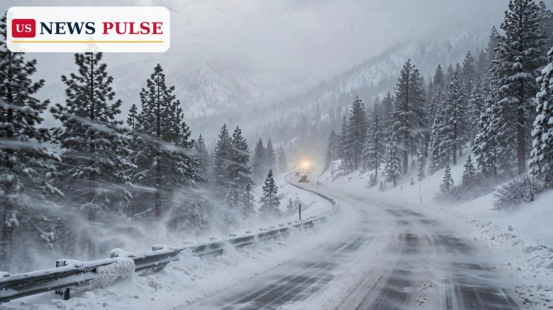
A Lake Tahoe winter storm watch is now in effect as forecasters warn a stronger, colder Sierra Nevada storm arriving late Tuesday, November 18, could dump up to 3 feet of snow and drive gusts of up to 80 mph, making mountain travel nearly impossible through Thursday night. The National Weather Service in Reno issued the watch on Sunday, November 15, as a second, harder hit looms. The incoming storm is colder and slower than Monday's system, which brings only a few inches.
Key Points
- The National Weather Service in Reno issued a winter storm watch Sunday, November 15, for Lake Tahoe ahead of a stronger storm due late Tuesday into Thursday.
- Forecasters expect 2 to 3 feet of snow above 7,000 feet and 8 to 18 inches near lake level, with gusts to 80 mph.
- Mountain travel could become nearly impossible through Thursday night, with Donner Pass seen as especially vulnerable.
- A quicker first storm on Monday brings only a few inches; the slower second storm on Wednesday and Thursday brings more than a foot more.
- AccuWeather also expects 2 to 4 inches of rain across Northern and Central California through Friday.
What Happened
The watch covers Lake Tahoe and the surrounding Sierra Nevada, where a powerful cold system arrives late Tuesday. Forecasters project 2 to 3 feet of snow above 7,000 feet and 8 to 18 inches near lake level. Gusts could reach 80 mph on exposed ridges and passes, blowing snow into whiteouts. The Weather Service warned that mountain travel could become nearly impossible through Thursday night, a warning that usually precedes closures on Interstate 80 and Highway 50.
The storm arrives in two parts. A quicker, weaker system moves through on Monday, dropping only a few inches. The main event follows Tuesday night into Wednesday and Thursday, when colder air wrings far more snow from the atmosphere. AccuWeather meteorologist Breanna Grill said Donner Pass, the high crossing on Interstate 80 west of Truckee, could be especially vulnerable, with Wednesday and Thursday bringing more than a foot more.
Background/Context
The watch follows the storm that struck the Sierra on Saturday, November 14, when a winter storm brought up to 24 inches of snow and gusts of 90 mph to the range. It was the season's first major Sierra snow, and it came with a powerful coastal swell: waves as high as 60 feet battered the California coast, flooding parts of Pacifica and closing beaches from Santa Cruz northward. The back-to-back storms show how fast the pattern has turned wintry across the West.
The Sierra snowpack is California's largest natural reservoir, and early storms set the tone for winter supply. Heavy November snow is welcome for ski resorts and reservoirs, but storms this strong also endanger the highways crossing the range. Interstate 80 over Donner Pass and Highway 50 over Echo Summit, the two main routes between the Sacramento Valley and Reno-Tahoe, are regularly closed or restricted in major snow. Further south, the Hanford weather office already has a winter storm warning in effect through Tuesday morning.
Lake Tahoe Winter Storm Watch: What the Forecast Shows
Above 7,000 feet, forecasters expect 2 to 3 feet from the second storm alone. Near lake level, the projection is 8 to 18 inches, enough to bury cars and shut local roads. Winds gusting to 80 mph will make it far worse than the totals suggest, with whiteouts and near-zero visibility on exposed stretches.
The storm's slow pace is what makes it dangerous. A fast system drops a foot of snow and moves on; a slow one feeds moisture into the mountains for two days, while cold air keeps the snow light and easily blown. That is the risk behind Grill's Donner Pass warning: the pass sits at 7,057 feet on Interstate 80 and is among the first places in the Sierra to close when snowfall and wind combine. The southern Sierra is already being hit: the Hanford warning, in effect through Tuesday morning, covers Wawona, Shaver Lake, Grant Grove, Tuolumne Meadows, Lodgepole and Devils Postpile, with up to 20 inches more snow. National Weather Service meteorologist Chris Johnston warned travel could become impossible on uncleared snow-covered roads there.
Reactions/Quotes
AccuWeather meteorologist Breanna Grill singled out Donner Pass as the place to watch. She said the pass could be especially vulnerable: a quick first storm on Monday brings only a few inches, while the slower second storm on Wednesday and Thursday brings more than a foot more. That is why the Weather Service issued the watch days early, giving travellers time to change plans.
In the southern Sierra, meteorologist Chris Johnston warned travel could become impossible on uncleared snow-covered roads. Forecasters have not said whether the Tahoe watch will be upgraded to a warning, the usual next step if the forecast holds.
Why It Matters
The storm hits the Sierra's main travel corridors at the start of a busy week. Thousands cross Donner Pass and Echo Summit daily, and a storm that makes travel nearly impossible for two days can strand travellers, halt freight between California and Nevada, and force mountain towns to scramble. Wind is as much a threat as snow: gusts to 80 mph can knock down trees and power lines and turn heavy snowfall into a blizzard.
It also matters for California's water outlook. The Sierra snowpack supplies about a third of the state's water, and early storms build the base reservoirs depend on. But the same storms can flood valleys when rain falls on fresh snow, and the 2 to 4 inches of rain forecast through Friday raises that risk. The flooding that struck the Southwest this month, killing two people in Flagstaff and prompting an Arizona emergency declaration, shows how fast rain on saturated ground can turn deadly.
What Happens Next
The first storm arrives Monday with a few inches of snow in the Sierra and rain in the valleys. The main storm follows late Tuesday, with the heaviest snow on Wednesday and Thursday. Forecasters will update the watch, and it will likely be upgraded to a winter storm warning for Tahoe if the totals hold. Travellers should check road conditions, carry chains, and be ready to delay Sierra trips until the storm passes on Friday.
FAQ
How much snow is expected around Lake Tahoe?
Forecasters expect 2 to 3 feet above 7,000 feet and 8 to 18 inches near lake level, from late Tuesday into Thursday.
When will the worst of the storm hit?
The heaviest snow falls Wednesday and Thursday, November 18 and 19, after a smaller Monday storm brings only a few inches. Travel could be nearly impossible through Thursday night.
How strong will the winds be?
Wind gusts could reach 80 mph in the mountains, creating whiteout conditions and blowing snow across highways.
Is the southern Sierra also affected?
Yes. A winter storm warning runs through Tuesday morning for southern Sierra communities including Wawona, Shaver Lake and Tuolumne Meadows, with up to 20 inches more snow expected.
Will it rain in the valleys?
Yes. AccuWeather expects 2 to 4 inches of rain across Northern and Central California through Friday.
© 2026 US News Pulse. All rights reserved.
 Print
 Save