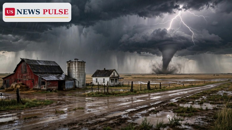
Scattered severe storms, damaging winds and a few tornadoes are possible on Monday, November 2, 2026, across parts of the central and southern Plains, the National Weather Service's Storm Prediction Center has warned, with a Slight Risk of severe thunderstorms covering much of Oklahoma, northern Texas and south-central and eastern Kansas.
The Day 2 Convective Outlook, issued early on Sunday, November 1, puts the main threat late Monday afternoon into the evening. Forecasters say storms should develop as a strong system moves east, first as supercells and line segments near a dryline, then increasingly as a line into Monday night, with damaging outflow gusts and a couple of tornadoes among the hazards, along with isolated large hail at first.
The warning is a forecast, not a report of tornadoes already on the ground. The Storm Prediction Center's outlook for Monday, valid from 12:00Z on November 2 to 12:00Z on November 3, describes a classic late-autumn Plains set-up: a strong upper-level system ejecting across the West, a dryline extending from central Kansas into western Oklahoma and west-central Texas, and warm, moist air with dewpoints in the mid-60s Fahrenheit across the warm sector.
Forecasters are confident storms will develop on Monday as the system approaches, with a few initial rounds of rain in the morning and early afternoon in Kansas, followed by more organised severe storms later in the day. The Topeka office said in a graphic posted early on November 1 that the risk would be greatest along and south of Interstate 70 in central and eastern Kansas, including the Topeka, Salina and Hutchinson areas.
National coverage has put the four-state alert in plain terms: Texas, Oklahoma, Kansas and Missouri are on alert for strong tornadoes on Monday, with a 2 to 5 percent chance of tornadoes within 25 miles of any given point in the risk area, alongside major rain and wind and large hail. That percentage sounds small, but in Storm Prediction Center language it is enough, combined with wind and hail, to justify a Slight Risk and a public warning to stay weather-aware.
November tornadoes are uncommon in Kansas, which is part of why this forecast has drawn attention. Shawnee County, home to Topeka, last saw a tornado in November in 1988, according to National Weather Service meteorologist Jennifer Prieto. That November 15, 1988, F-2 twister damaged 107 homes and 15 businesses in south-west Topeka and injured 22 people seriously enough to need medical treatment, although no one was killed, according to Topeka Capital-Journal archives.
Autumn severe weather in the Plains is driven by a different balance than spring. Instability is usually lower, but wind shear - the change in wind speed and direction with height - can be very strong, and that shear can spin up tornadoes even when the atmosphere is not as unstable as in May. The Storm Prediction Center's Monday discussion makes exactly that point: effective storm-relative helicity of 200 to 300 square metres per second squared will be common, with 1,000 to 1,500 joules per kilogram of instability in the most favourable zone, enough for supercells near the dryline and for embedded circulations as storms become more linear overnight.
The same system is also bringing heavy rain and flash flooding to the Four Corners region over the weekend, with high-elevation snow in the West, before rain and wind enter the Central Plains by Monday. The Weather Prediction Center warned on Saturday afternoon that heavy rainfall with significant flash flooding was likely across Arizona, Colorado, New Mexico and Utah, a reminder that Monday's Plains storms are one part of a larger, cross-country system.
The highest-risk window, in the current outlook, is late Monday afternoon into the evening. Initial cell development is expected from south-central Kansas into western Oklahoma and north-west Texas after 21Z, which is 4 p.m. Central Standard Time in the new winter clock, with increasing coverage through the evening as the system moves east. Storms should tend to evolve into more linear structures into Monday night, with a continued threat for occasional wind damage and a couple of tornadoes with embedded circulations, and decreasing instability after 06Z.
In Kansas, the Topeka office's message is more local: a slight chance of severe weather, including potential tornadoes, during the late afternoon and early evening on November 2 in parts of Kansas that include Topeka, Salina and Hutchinson. The risk is greatest along and south of Interstate 70 in central and eastern Kansas. That corridor includes the state's most populous eastern counties and the Kansas City metro fringe, so even a slight risk deserves attention from commuters and evening travellers.
Forecasters also flag the main uncertainty. Cloud cover and rain through the day could limit how much energy storms have by the afternoon and evening, limiting storm intensity. The Topeka office put it this way: even with limited instability, the environment could be favourable for damaging wind gusts and a tornado or two given strong wind parameters. In other words, a cloudy, rainy day does not rule out a tornado on Monday.
The Storm Prediction Center's outlook, issued at 01:02 a.m. Central time on Sunday, November 1, states: "Scattered severe storms are expected across parts of the central and southern Plains late Monday afternoon into the evening, with damaging wind gusts and a few tornadoes the main threats."
The centre adds: "At least a narrow zone of supercell potential is evident near the dryline late in the day, with a few tornadoes and damaging wind possible. The severe risk should persist through the late evening with damaging winds and possible QLCS storm mode, along with an isolated tornado risk."
The Topeka office, in its local discussion, warned: "However, even with limited instability, the environment could be favourable for damaging wind gusts and a tornado or two given strong wind parameters." That sentence is the core safety message for Kansas residents: do not judge Monday's risk by how the morning looks.
Monday is a school and work day, and the severe window falls in the late afternoon and evening, when people are driving home, attending evening events and, in Kansas and Oklahoma, preparing for the final day before the November 3 midterm elections. A tornado warning during that window, even for a small area, can disrupt travel, close schools and force people into shelter with little notice.
The forecast also matters because November tornadoes, while rare in any one county, can be dangerous precisely because people do not expect them. The 1988 Shawnee County tornado is a local reminder: a November twister damaged more than 100 homes and injured 22 people in a single county. Modern warning systems are far better than in 1988, but they only help if people have a way to receive a warning and a safe place to go.
For the wider Plains, Monday's storms are a test of autumn preparedness. Farmers, truck drivers on Interstate 70 and Interstate 35, and residents in mobile homes - who are disproportionately at risk in tornadoes - need to plan now, not when a warning is issued.
The Storm Prediction Center will issue an updated Day 1 outlook on Monday morning, and local National Weather Service offices in Topeka, Wichita, Norman, Fort Worth and Kansas City will refine watches and warnings through the day. A Severe Thunderstorm Watch or Tornado Watch is possible for parts of the risk area on Monday afternoon, and individual warnings will follow if storms develop rotation or damaging winds.
Residents in Kansas, Oklahoma, northern Texas and Missouri should check the forecast again on Monday morning, keep a phone or weather radio charged and able to receive Wireless Emergency Alerts, know the safest room in their home - an interior room on the lowest floor, away from windows - and avoid driving through flooded roads, since heavy rain and flash flooding are also part of this system.
US News Pulse will report any tornado warnings, confirmed tornadoes or damage from Monday's storms as they are confirmed.
Where is the tornado risk on Monday, November 2, 2026? The Slight Risk covers much of Oklahoma, northern Texas and south-central and eastern Kansas, with Missouri also on alert in national summaries. In Kansas, the risk is greatest along and south of Interstate 70 in central and eastern Kansas.
When are storms most likely? Late Monday afternoon into the evening, with initial development after about 4 p.m. Central time and increasing coverage through the evening into Monday night.
What are the main threats? Damaging wind gusts and a few tornadoes are the main threats, with isolated large hail possible at first and heavy rain and flash flooding also possible.
Is a tornado certain in Kansas on Monday? No. The forecast is for a slight chance of severe weather, including a tornado or two. A conditional EF2 risk exists, but cloud cover and rain could limit intensity.
What should I do to prepare? Check Monday morning's updated outlook, keep a weather radio or phone alerts on, know your safe room, and never drive through flooded roads or try to outrun a tornado in a vehicle.
Related coverage: Powerball Results Oct 31: No Jackpot Winner as $793 Million Rolls to Monday, New York Unemployment System Goes Offline Nov 2, Payments Delayed 9 to 12 Days and Judge Dismisses Alaska Senate Lawsuit in Blow to Trump Bid to Block Certification.
Leave a Comment



 | Today's Date: