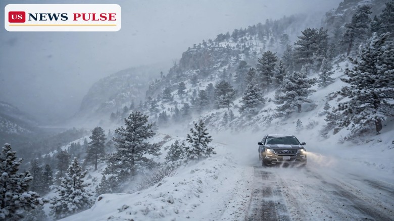
Bighorn winter storm watch warnings are in place for the high country of Montana and Wyoming, where the National Weather Service office in Billings, Montana, has warned of moderate to heavy snow, strong winds and sharply reduced visibility from Sunday evening through Monday evening. Up to 8 inches of snow is possible in the Pryor and northern Bighorn Mountains of Montana and the northeast Bighorn Mountains of Wyoming, with wind gusts of 40 to 50 mph and visibility dropping below a quarter of a mile in falling and blowing snow.
The watch covers a rugged, high-elevation part of the Northern Rockies at the start of a busy weather stretch before Tuesday's midterm elections. Forecasters stressed that recreation in the high country could be affected by accumulating and blowing snow, and they urged travellers and outdoor enthusiasts to monitor updated forecasts as the storm develops.
The watch was reported on Sunday, November 1, 2026, by Men's Journal and The Spun, drawing on the National Weather Service's Billings outlook. The warning states: "Moderate to heavy snow possible. Total snow accumulations up to 8 inches possible. Winds could gust 40 to 50 mph." It adds: "Visibilities may drop below 1/4 mile due to falling and blowing snow. Recreation in the high country could be impacted by accumulating snow and blowing snow."
The timing matters. A Winter Storm Watch is issued in advance of a hazardous winter event, usually at least 24 hours ahead, when forecasters judge that the risk has increased but the exact occurrence, location or timing is still uncertain. According to the Weather Service, a watch indicates at least a 50 percent chance of the event occurring and is intended to give people enough lead time to make plans to stay safe.
As the event becomes imminent, a watch is normally upgraded to either a warning or an advisory. A warning indicates an 80 percent or greater probability, conditions that pose a threat to life or property, and travel that will become difficult to impossible. An advisory indicates conditions that pose a significant inconvenience and, if caution is not exercised, could become a threat to life or property. For now, the Bighorn outlook remains a watch, not a warning — a distinction that matters for how seriously travellers should treat the forecast, and for how quickly conditions could change.
The watch is specific to mountain terrain, not to the whole of either state. In Montana, it covers the Pryor Mountains and the northern Bighorn Mountains. In Wyoming, it covers the northeast Bighorn Mountains. Those are the higher, more exposed parts of the range, where snow can accumulate faster and wind can move it across roads and trails even after it has stopped falling.
The window runs from Sunday evening through Monday evening, local time. That puts the worst of the expected snow and wind across Sunday night and into Monday, when many people will be travelling, working or heading to early voting locations in lower-elevation towns. Mountain roads, passes and trailheads are the places most likely to be affected, and conditions in the valleys below may look very different from conditions at elevation.
The National Weather Service's Billings area forecast discussion from Saturday, October 31, gave more detail on the system behind the watch. It described widespread precipitation, with a 70 to 90 percent chance, and breezy conditions of 20 to 40 mph on Sunday into Monday, with stronger winds possible over the Bighorn foothills and along the Dakota border on Monday. There was a 60 percent chance of gusts greater than 50 mph in that discussion, and forecasters noted that snow levels would start high before falling overnight Sunday into Monday morning as colder air moved in.
The Bighorn watch is part of a much wider spell of unsettled weather across the western United States over the weekend of October 31 to November 2. Earlier in the weekend, winter advisories covered parts of Idaho, the Sierra Nevada and the central mountains of Colorado, with up to 10 inches in parts of the Sierra above 7,000 feet and up to 18 inches at the highest peaks. A separate severe-weather outlook warned of storms and possible tornadoes on Monday across Kansas, Oklahoma, northern Texas and Missouri, while Las Vegas faced flash-flood warnings as persistent rain continued.
The Bighorns themselves are a popular recreation area, with hiking, hunting, skiing and scenic driving drawing visitors through the autumn and into winter. Forecasters singled out recreation in the high country for a reason: a trail or a back road that is passable in the morning can become difficult by afternoon when wind picks up and visibility falls. Checking the latest forecast, telling someone where you are going, and being prepared to turn back are the practical steps that matter most in a watch of this kind.
There has been no report of a major incident linked to the Bighorn watch in the reporting read for this article, and the story so far is a forecast, not an aftermath. The official language is deliberately measured: "moderate to heavy snow possible" and "monitor the latest forecasts for updates on this situation." That wording reflects the nature of a watch, which is a warning to prepare, not a statement that the worst outcome is certain.
The watch matters because blowing snow is more dangerous than snowfall totals alone suggest. Eight inches of snow on a calm day is an inconvenience; 8 inches combined with 40 to 50 mph gusts and visibility below a quarter of a mile is a travel hazard. Drivers can lose the road edge, become disoriented in whiteout conditions, or slide on snow that has drifted across a pass. Hikers and hunters in the high country face the same visibility problem on foot, with fewer options for shelter.
It also matters because of timing. Monday is a working day, and Tuesday is Election Day, when many people will be travelling to polling places. A mountain watch that ends on Monday evening should not, on its own, disrupt voting in the valleys, but it is a reminder that weather in the West this week is active, varied and local. A forecast for one elevation or one county may not describe conditions a few miles away or a few thousand feet higher.
The next update will come from the National Weather Service in Billings, which will either upgrade the watch to a warning or advisory, extend it, or let it expire as the storm passes. Travellers in the Bighorns should check the latest Billings forecast and road reports before setting out on Monday, and should be prepared for the possibility that a mountain road or pass is closed or restricted.
If the snow and wind arrive as forecast, the story will move from preparation to impact: road closures, travel delays, and any incidents in the high country. If the storm is weaker than expected, the watch will have done its job anyway — giving people a day's notice to plan, postpone or prepare. Either way, the forecast for the rest of the week, and for Election Day itself, will be the next thing to watch.
What is a Winter Storm Watch? It is an advance alert, usually issued at least 24 hours ahead, indicating at least a 50 percent chance of a hazardous winter event. It gives people lead time to plan, while the exact timing, location and amounts are still uncertain.
Which areas are covered by the Bighorn watch? The Pryor Mountains and northern Bighorn Mountains in Montana, and the northeast Bighorn Mountains in Wyoming, from Sunday evening through Monday evening.
How much snow is expected? Moderate to heavy snow, with total accumulations of up to 8 inches possible, and wind gusts of 40 to 50 mph that could cut visibility below a quarter of a mile in blowing snow.
Is this a warning? No, not yet. A watch is a step below a warning. A warning would indicate an 80 percent or greater probability and conditions posing a threat to life or property, with travel difficult to impossible.
Related coverage: Severe storms and tornadoes possible Monday across Kansas, Oklahoma and Texas, Winter snow weekend: up to 18 inches in Sierra as advisories hit 3 states, Las Vegas flash flooding: NWS warns of flood risk across Nevada and Arizona.
Leave a Comment



 | Today's Date: