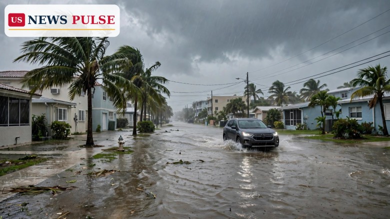
South Florida is under a Flood Watch from Sunday morning through Monday afternoon, November 1-2, 2026, as repeated bands of heavy rain threaten street flooding across Palm Beach, Broward and Miami-Dade counties. The National Weather Service in Miami issued the watch at 12:43 a.m. on Sunday, warning that scattered locations could pick up 3 to 5 inches of rain through Monday, with isolated spots seeing 5 to 7 inches in just a few hours.
The watch runs from 10 a.m. Sunday to 3 p.m. Monday, and it covers all three South Florida counties in full. The danger is not a single storm, but repetition: an upper-level low parked over Florida is pulling in moisture and sending band after band of rain over the same coastal areas, on top of high tides that are already pushing water toward streets, lots and parks.
The National Weather Service in Miami issued the Flood Watch in the early hours of Sunday, after an upper-level low settled over Florida. The system is not a hurricane or a tropical storm, but it does not need to be one to flood South Florida streets. The low is drawing moist air over the east coast, and the resulting rain bands are expected to train over the same areas again and again.
That repetition is the key to the forecast. A single heavy shower on dry ground drains away. Repeated bands over saturated ground, with nowhere for the water to go, fill streets, overwhelm drains and turn low-lying roads into shallow lakes. The Weather Service's warning reflects that pattern: scattered spots could see 3 to 5 inches through Monday, but isolated locations could receive 5 to 7 inches within a few hours if the heaviest bands stall overhead.
The watch also warns that the heaviest rain falling near the coast at high tide would make flooding worse. High tide at Government Cut, the inlet at Miami Beach, was predicted for 1:18 p.m. on Sunday, with low tide following at 7:35 p.m. When heavy rain and high tide coincide, water has less room to drain, and coastal streets flood first and stay flooded longest.
For Sunday itself, the forecast called for a 90 percent chance of showers and thunderstorms in the Miami Beach area, with a high near 83 degrees and east winds gusting to 24 mph. Another 1 to 2 inches could fall on Sunday night, and Monday brings another 90 percent chance of storms. In other words, there is no dry break in the forecast until after the watch expires on Monday afternoon.
South Florida is especially vulnerable to this kind of rainfall for reasons that have little to do with storm strength. Much of the coastal plain sits only a few feet above sea level, the water table is high, and the drainage system depends on gravity and pumps moving water toward the ocean and the canal system. When rain falls faster than it can drain, and when high tide blocks the outflows, streets flood even without a named storm.
That is also why a Flood Watch and a Flood Warning mean different things, and why residents should not wait for an upgrade to take the watch seriously. A watch means conditions are favourable for flooding; a warning means flooding is already occurring or is imminent. The current watch is a signal to prepare — to move cars from low-lying streets, to avoid driving through standing water, and to check later forecasts — before any individual neighbourhood is placed under a warning.
The timing adds a further complication. Sunday, November 1, is the last day of early voting before Tuesday's midterm elections, and it is also the day daylight saving time ends, with clocks falling back an hour. In Miami Beach, the city's two early-voting sites — City Hall at 1700 Convention Center Drive and the North Shore Branch Library at 7501 Collins Avenue — were scheduled to be open from 7 a.m. to 7 p.m. on Sunday. Voters heading to those sites, and anyone else travelling in South Florida, face the same advice: allow extra time, expect road closures, and never drive through flooded roads where the depth and the condition of the road surface cannot be seen.
Across the three counties, the expected impacts are described by the Weather Service as limited in their effect on buildings, but real for travel and daily life. The main risks are flooded streets, road closures and limited impacts in flood-prone areas, especially where the heaviest rain falls near the coast at high tide.
In Miami-Dade County, including Miami Beach and the barrier-island towns, the picture is sharpened by the coastal flood advisory that runs alongside the Flood Watch until 7 p.m. on Monday. That advisory warns of minor to moderate flooding of lots, parks and roads, with only isolated road closures expected — but "isolated" still means real closures for the drivers who meet them, and barrier islands have fewer alternative routes than the mainland.
The city of Miami Beach has already adjusted its Sunday plans. Its French Market at South Pointe Park was called off for Sunday because of the forecast, a small but telling sign of how seriously local officials are taking a weekend of repeated rain. The city also reminded residents that early voting continues on Sunday, so the rain is not a reason to stay away from the ballot box — it is a reason to plan the trip carefully.
Broward and Palm Beach counties face the same watch and the same rainfall totals. The watch covers all of both counties, not just the coast, so inland neighbourhoods with poor drainage, low-lying roads and canals running high are also at risk when the heaviest bands pass over.
No evacuation orders or emergency declarations accompanied the Flood Watch on Sunday morning, and the early reporting did not include direct quotations from Weather Service forecasters beyond the watch itself. The official message, as issued at 12:43 a.m., was practical rather than dramatic: monitor later forecasts, be alert for possible Flood Warnings, and be prepared to take action if flooding develops in areas prone to it.
Local reporting in Miami Beach echoed that practical tone, noting the cancelled French Market, the coastal flood advisory and the rip-current danger, and pointing residents to the National Weather Service for the latest alerts before making plans. That is the right response to a watch of this kind: it is not a prediction that every street will flood, but a warning that some streets almost certainly will, and that no one can say in advance exactly which ones.
A Flood Watch covering three counties and more than six million people matters even when no hurricane is involved, because the most common flood deaths in the United States happen in vehicles driven into standing water. Six inches of fast-moving water can knock a person off their feet, and 12 inches can carry away a small car. The Weather Service's repeated advice — turn around, don't drown — exists because drivers routinely underestimate water that looks shallow.
The watch also matters because of its duration. A single afternoon of heavy rain is an inconvenience. Thirty hours of repeated bands, from Sunday morning to Monday afternoon, with high tides in between, is a test of drainage, of road networks and of patience. It is also a test that comes at a sensitive moment: the final day of early voting, the first weekend after the clocks change, and the run-up to Election Day itself.
For South Florida's coastal communities, the weekend is another reminder of a longer-term reality. Sea level, high tides and intense rainfall are combining more often, so that flooding that once required a major storm can now happen under an upper-level low on an ordinary November weekend. The watch is for this weekend only, but the pattern behind it is not going away.
The Flood Watch remains in effect until 3 p.m. on Monday, November 2, and the coastal flood advisory for Miami-Dade runs until 7 p.m. on Monday. Residents should expect updates through the weekend: watches can be extended, upgraded to warnings for individual areas, or allowed to expire early depending on rainfall and river and canal levels.
The most important updates to watch for are Flood Warnings for specific neighbourhoods, which would mean flooding is occurring or imminent there, and any changes to the rainfall totals if the heaviest bands stall over one county rather than spreading across all three. Drivers should check the National Weather Service's latest alerts before travelling, avoid flooded roads, and never walk or drive through water of unknown depth.
After Monday afternoon, the immediate threat should ease as the upper-level low moves on, but saturated ground will remain vulnerable to any further rain. Anyone in a flood-prone area should keep drains clear, keep valuables off the ground floor where possible, and keep an eye on the forecast until the ground has had time to dry.
Which counties are under the South Florida Flood Watch?
Palm Beach, Broward and Miami-Dade counties — all of South Florida's east-coast counties — from 10 a.m. Sunday, November 1, to 3 p.m. Monday, November 2, 2026.
How much rain is expected?
Scattered locations could receive 3 to 5 inches through Monday, with isolated spots seeing 5 to 7 inches in a few hours where the heaviest bands stall.
What is the difference between a Flood Watch and a Flood Warning?
A watch means conditions are favourable for flooding. A warning means flooding is already occurring or is imminent in a specific area.
Is it safe to drive through a flooded street?
No. Never drive through standing water of unknown depth. Six inches of fast-moving water can knock a person down, and 12 inches can carry away a small car. Turn around and find another route.
Are there other hazards besides flooding?
Yes. Dangerous rip currents are expected through Monday evening, and a coastal flood advisory for Miami-Dade runs until 7 p.m. Monday, with minor to moderate flooding of lots, parks and roads.
Related coverage: Record king tides flood California and Florida coasts in historic week, Phoenix Halloween rain forecast: first wet October 31 in nearly 40 years, and Thunderstorms hit 19 states today as NWS warns of heavy rain, wind and hail.
Leave a Comment



 | Today's Date: