

 | Today's Date:




San Francisco Bay Area Flooding: Record Rain Closes Big Sur Highway 1 - US News Pulse
A powerful atmospheric river flooded the San Francisco Bay Area on Wednesday, setting a daily rainfall record in San Francisco and shutting down roads, flights and one of California's most famous highways. San Francisco recorded 2.28 inches (5.8 cm) of rain in a single day, the most ever measured on that date, as the storm closed a 45-mile stretch of Highway 1 through Big Sur.
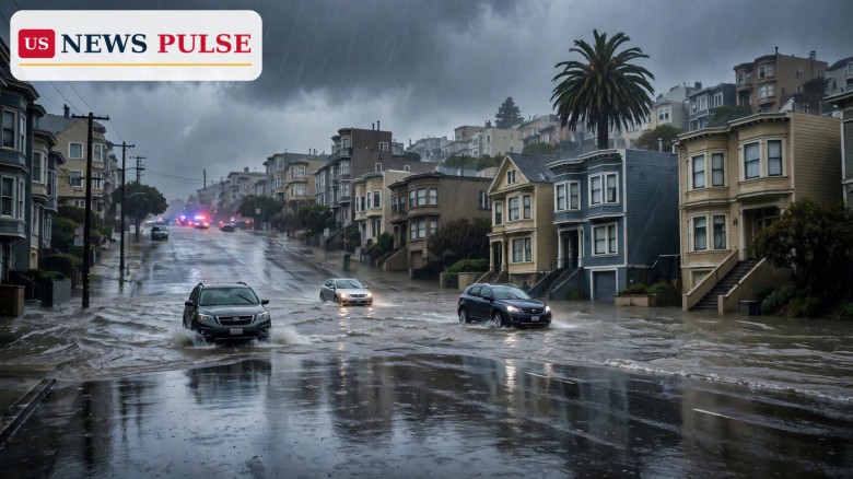
The San Francisco Fire Department answered more than 300 calls on Wednesday morning, most of them for flooding, fallen trees and downed electrical wires, Fire Chief Dean Crispen said. Floodwater closed streets from the Mission District to Richmond, blocked a stretch of Interstate 580, and left more than 16,000 homes and businesses without power. At San Francisco International Airport, departing flights were delayed by an average of 186 minutes.
Key Points
- San Francisco set a daily rainfall record of 2.28 inches (5.8 cm) on Wednesday, November 18, 2026.
- The San Francisco Fire Department answered more than 300 calls on Wednesday morning, mostly for flooding, downed trees and wires.
- SFO was placed on a ground delay programme: 186-minute average departure delays, 27 cancellations, 432 delayed flights.
- Caltrans closed about 45 miles of Highway 1 in Big Sur, from Nepenthe to Ragged Point, over debris-flow risk from recent burn scars.
- More than 16,000 Bay Area customers lost power, and over five inches of rain is expected through Friday morning.
What Happened
The storm arrived in the Bay Area on Wednesday morning and quickly intensified. Forecasters upgraded it to a Level 3 storm, and the National Weather Service issued a rare severe thunderstorm warning for parts of San Mateo County, where wind speeds were expected to reach up to 70 mph. In San Francisco, the worst flooding was in the Mission District, where water came up through storm drains at 17th and Folsom streets. Near the Panhandle, streets at Oak and Cole were completely flooded, and a stalled Waymo vehicle blocked traffic. Waymo has since paused its driverless service in the Bay Area.
South San Francisco was hit hard near Highway 101 and Interstate 280, where standing water covered South Airport Boulevard at US-101. In the East Bay, El Cerrito, San Pablo and Richmond closed numerous streets, including Rumrill Boulevard, Cutting Boulevard and the Barrett Avenue and MacDonald Avenue underpasses at Amtrak. Westbound Interstate 580 was blocked in Alameda County, and highways were affected in Napa, Marin, San Mateo and Santa Clara counties. Ferry service was disrupted. PG&E reported about 16,671 customers without power as of 2 p.m., including 9,403 in the East Bay. At SFO, the ground delay programme brought average departure delays of 186 minutes, 27 cancellations and 432 delayed flights.
Background and Context
An atmospheric river is a long, narrow band of moisture that carries huge amounts of water vapour from the Pacific to the West Coast. When it hits California's coastal mountains, that moisture falls as intense rain in a few hours, overwhelming rivers and storm drains. This storm is the most widespread of the season so far, arriving on ground already saturated by weekend storms. The same system is bringing up to four feet of snow to the Sierra Nevada.
Big Sur's Highway 1 is one of California's most famous roads, linking the Monterey Peninsula with San Luis Obispo County, but also one of its most fragile. After wildfires, rain can loosen ash, soil and rock on burned hillsides and send debris flows onto the road. The Timber and Plaskett fires burned in the Big Sur area in recent months, leaving exactly that risk behind.
San Francisco Bay Area Flooding Hits Roads, Flights and Power
The flooding cut across every part of the Bay Area at once. In San Francisco, the Fire Department's 300-plus calls covered flooding, fallen trees and electrical wires. The airport bore the brunt of the travel disruption: SFO's ground delay programme meant thousands of travellers waited hours to leave, 27 flights were cancelled outright, and FlightAware counted 432 delayed flights. Ferry services were also disrupted.
The power outages showed how unevenly the storm hit the region. The East Bay accounted for more than half of PG&E's 16,671 outages at 2 p.m., with 9,403 customers dark, while the Peninsula had 3,358 and the North Bay 1,550. Further south, the Big Sur closure was the storm's most dramatic road shutdown: Caltrans closed a roughly 45-mile stretch of Highway 1 from Nepenthe to Ragged Point, and drivers were directed to use US Highway 101 instead.
Reactions and Quotes
PG&E warned residents to stay away from any downed power lines, saying that touching them is "extremely dangerous", and said customers should report them by calling 911 and then PG&E at 1-800-743-5002. Waymo has paused its Bay Area service, saying safety is its top priority for riders and everyone it shares the road with. SFO spokesperson Doug Yakel said there were 27 cancellations and advised travellers to check directly with their airline. Officials also cautioned drivers never to drive through flooded roadways, since standing water can be deeper than it appears. Caltrans crews will assess Highway 1 early on Thursday morning.
Why It Matters
The storm matters because it tested California's infrastructure in a single day, and in several places at once. A record day of rain in San Francisco, a 45-mile closure of the state's most famous coastal highway, a three-hour average delay at one of the country's busiest airports and more than 16,000 power outages add up to a region-wide disruption, not a localised flood. The Big Sur closure also shows how wildfire and weather now combine in California: the Timber and Plaskett fires burned the hillsides above Highway 1 only months ago, and the first major storm of the season turned those burn scars into a debris-flow threat.
What Happens Next
More rain is coming. The National Weather Service forecasts more than five inches of rain across the region through Friday morning, with another round of showers, strong winds and thunderstorms on Thursday, and a coastal flood warning in effect until Friday morning, November 20. Rain is also moving down the coast toward Los Angeles overnight into early Thursday. Flash flooding is possible along the entire Central and Southern coastline on Thursday, with two to four inches of rain possible from San Jose to Los Angeles County. Caltrans crews will reassess the Big Sur closure early on Thursday morning.
Frequently Asked Questions
How much rain did San Francisco get?
San Francisco recorded 2.28 inches (5.8 cm) on Wednesday, November 18, 2026, a daily record.
Is Highway 1 in Big Sur closed?
Yes, Caltrans closed a roughly 45-mile stretch from Nepenthe to Ragged Point over debris-flow risk, and drivers should use US Highway 101.
How bad are the delays at SFO?
SFO was on a ground delay programme with average departure delays of 186 minutes, 27 cancellations and 432 delayed flights.
How many customers lost power?
PG&E reported about 16,671 customers without power at 2 p.m. on Wednesday, with the East Bay hardest hit at 9,403.
Read more: California Atmospheric River Storm Brings Flooding Rain and 4 Feet of Sierra Snow | Florida Flooding in Hollywood and Broward

The US News Pulse newsroom covers breaking news across the United States and the world, working from wire services, official statements and on-the-record sources. Every story is reviewed against our editorial standards before publication. Corrections and tips: info@usnewspulse.com
About our newsroomLeave a Comment