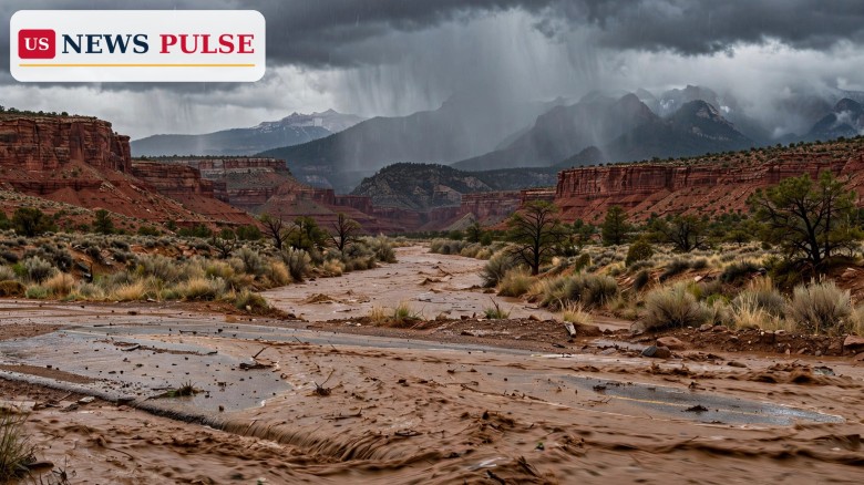
The Four Corners flood risk is back at the top of the national weather map this weekend. The Weather Prediction Center has placed the Four Corners under a Moderate Risk of excessive rainfall for Sunday, November 1, warning that a high-impact heavy rainfall event is likely to unfold over ground that is still saturated from last week's flooding. For communities in New Mexico, Colorado, Utah and Arizona that are still cleaning up, the forecast is not a routine autumn shower: it is a second soaking, aimed at the same rivers, the same canyons and the same saturated soils that flooded only days ago.
The warning covers the period from 12:00 UTC on November 1 through 12:00 UTC on November 2. A Moderate Risk is the second-highest level on the Weather Prediction Center's four-tier excessive-rainfall scale, and it means at least a 40% probability that rainfall will exceed flash-flood guidance within 25 miles of any given point. Forecasters say moisture running four to five standard deviations above normal will stream into the San Juan Mountains, with persistent southwesterly flow into the terrain producing about 18 hours of steady heavy precipitation.
The forecast took shape in the Weather Prediction Center's Friday excessive-rainfall discussion, which was coordinated with the National Weather Service office in Albuquerque. The centre said, in its own words, that "a high-impact heavy rainfall event is likely to unfold across the Four Corners region on Sunday". The reason for the elevated risk is not just the amount of rain, but the timing: the short gap since the region's last major rainfall event means soils have had almost no chance to dry out.
"In a near-repeat of last week's heavy rain event, the still saturated soils will quickly convert nearly all of the rain into runoff," forecasters wrote, warning of "fast and steep rises along area streams and creeks as well as the larger San Juan river". Snow levels are forecast to rise above about 11,000 feet, leaving most middle elevations and valleys exposed to heavy rain rather than snow, so runoff will flow straight into the headwaters of the San Juan River.
Local National Weather Service offices have translated that national outlook into Flood Watches on the ground. The Albuquerque office issued a watch from early Sunday through Monday morning for northwest, west-central and north-central New Mexico, including the Chuska, Jemez and Tusas mountains near Chama, with 1 to 2 inches expected near and west of the Continental Divide over very saturated soils. The Grand Junction office issued watches for southwest Colorado and southeast Utah, including the Four Corners, the Upper Dolores, Animas and San Juan river basins, the southwestern San Juan Mountains and parts of southeastern Utah, with 1 to 3 inches forecast from November 1 into November 2. Flagstaff's weekend watches cover Coconino, Navajo and Apache counties, including the Navajo Nation, with another 1 to 3 inches possible over saturated ground. Tucson's watch covers much of southeastern Arizona, with half an inch to an inch in valleys and 1 to 2 inches or more in mountain areas.
To understand why forecasters are so concerned, it helps to look at what happened only last week. In northwest New Mexico, heavy rain sent the San Juan River and its tributaries out of their banks in what local officials described as a historic flood. KSUT reported that the San Juan River at Farmington rose from about 3.5 feet to 14 feet in roughly 36 hours, breaking a record set in 1909, with surges coming from Gobernador Canyon and Canon Largo. Devin Neeley told the station: "This is a catastrophic flood of historic proportions," and said 200 to 300 people had been rescued.
The human cost was real. The weather service recorded at least one death in that event, in a storm report from the Rio Arriba County emergency manager, which said a man was swept away in his truck at a low-water crossing about 13 miles south of Pagosa Junction on the night of October 23. President Donald Trump signed an emergency declaration covering San Juan, Cibola, Rio Arriba and Sandoval counties along with several pueblos and tribes, with the federal government covering 75% of eligible costs, the Albuquerque Journal reported. Governor Michelle Lujan Grisham estimated recovery would cost $200 million to $300 million and approved $8.25 million in state funds. About 1,500 residences were under evacuation orders at one point, and about 500 homes were damaged in the Shiprock area, according to the Journal, which cited the Navajo Nation.
Further south, Socorro County was still flooding on Friday. The Albuquerque weather service kept flood warnings in effect until noon MDT Friday for parts of the county. One warning said flooding caused by a levee breach was occurring in the San Francisco area near Bernardo, listing La Joya, Bernardo, San Francisco and Contreras among the affected locations. A second warning covered south-central Socorro County, citing flooding in the Escondida and Pueblito communities and impassable roads near San Pedro. The trouble began last weekend on the Rio Puerco, a tributary that meets the Rio Grande near Bernardo. El Defensor Chieftain reported that the river broke its banks around 3:30 p.m. Sunday, and residents of the San Francisco community off U.S. Highway 60 were told to evacuate about an hour later. Socorro County Emergency Manager Fred Berger told the newspaper that water was running about 5 feet deep across roadways and that the flooding was more severe than an event weeks earlier. A woman was swept away when floodwater overtook a vehicle; four other people in the vehicle escaped, and her body was recovered Monday after crews searched with a helicopter and drones. Boat teams and the New Mexico National Guard evacuated nine residents and about 11 dogs on Monday, the Chieftain reported, and U.S. 60 was closed just east of the Interstate 25 Bernardo exit while a BNSF rail line was washed out. In a delayed storm report, the county emergency manager said a levee breach late Tuesday forced evacuations in Escondida and Pueblito, with nine rescues carried out and 31 homes evacuated, and Bosquecito Road, Quebradas Road and U.S. Highway 380 near San Pedro impassable. The county opened an emergency shelter at Finley Gym in Socorro, and by Thursday the state Department of Transportation had reopened one lane of U.S. 380 near mile marker 2 with flaggers, warning of standing water on the road.
The Four Corners flood risk is dangerous precisely because the ground cannot absorb what is coming. In a normal storm, dry soil soaks up the first inch or more of rain. On saturated ground, almost every drop runs off, and it runs off fast, into washes, arroyos, slot canyons, burn scars and low-water crossings that can go from dry to deadly in minutes. That is why the Weather Prediction Center's discussion stresses the short interval between big rainfall events: it is the repeat, not just the rain, that creates the risk.
The terrain makes the danger worse. The San Juan Mountains force moist Pacific air upward, squeezing out rain over the same slopes again and again for roughly 18 hours. That rain feeds the Animas and La Plata rivers, which flow into the San Juan, the river that saw record flooding last week. The Albuquerque office's hydrologic outlook named Aztec, Bloomfield, Farmington and Shiprock, rated confidence in widespread rain as high but confidence in river flooding as low, and said rivers in San Juan County are expected to rise but stay below flood stage. That distinction matters: a river can stay below its official flood stage while smaller streams, washes and roads flood dangerously, and forecasters warn that flash flooding is possible in low-lying areas, slot canyons and other sensitive terrain.
A broader Slight Risk covers all of Arizona and parts of surrounding states, and the Weather Prediction Center said parts of central Arizona could require an upgrade. Around Phoenix, a separate round of watches begins late October 31 and continues through early November 2, with another 1 to 2 inches forecast around the city and 2 to 3 inches possible in some higher-elevation areas. Scattered to numerous thunderstorms are also forecast mainly from central into eastern Arizona, with the highest amounts extending from the Mogollon Rim toward the White Mountains.
Governor Lujan Grisham has already warned displaced residents not to rush home. "We don't want you back till the next rainstorm that we are predicting at the end of this upcoming weekend has passed," she said, according to the Albuquerque Journal. It was a blunt message, and this weekend's forecast is exactly the storm she was pointing to.
Forecasters have been equally direct. The Weather Prediction Center's warning of a "high-impact heavy rainfall event" and of saturated soils converting "nearly all of the rain into runoff" leaves little room for doubt about the mechanism, even if the exact locations of the worst flash flooding cannot be pinned down in advance. The Albuquerque office's watch puts it plainly: the rain will fall "over very saturated soils which will increase runoff" in areas "also areas that are still recovering from the last flood event", though river rises "are not expected to be as high as the last flood event".
Local reporting has captured the scale of what residents are already living through. Neeley's description of the Farmington flood as "a catastrophic flood of historic proportions" is borne out by the numbers: a river rising more than 10 feet in about a day and a half, a record dating to 1909 broken, and hundreds of rescues. Berger's account from Socorro County, of water 5 feet deep across roadways, shows that the danger is not confined to the San Juan basin. It is spread across the state, from the northwest to the Rio Grande valley, and the new storm threatens both.
This storm matters because it arrives before recovery has begun in any real sense. Homes in Shiprock are damaged, roads in Socorro County are still closed or running under flagger control, a rail line is washed out, and families are still in shelters or staying away from homes they were told not to return to yet. A second heavy rainfall event does not just add water; it interrupts repairs, re-floods roads that crews have just reopened, and forces emergency managers to choose again between keeping people away from home and letting them back into harm's way.
It also matters beyond New Mexico. The Four Corners region sits at the meeting point of four states, and its rivers do not respect state lines. Rain in the San Juan Mountains of Colorado becomes runoff in New Mexico; rain in southeast Utah becomes flow in the San Juan and Colorado river systems. Flash flooding in slot canyons and on tribal lands, where warnings may reach people later and roads may be fewer, carries a particular risk for hikers, drivers and rural communities. And with the storm system moving on, the hazards change rather than end: severe thunderstorms with hail, damaging wind and tornadoes are possible in central and eastern New Mexico on Sunday night, followed by colder air Monday that drops snow levels to 8,000 to 9,000 feet, with 1 to 4 inches of snow possible in the northern mountains and wind gusts to 50 mph.
The main rain system is expected to move away during Monday, followed by a broader drying trend from Tuesday, November 3, according to the outlooks reported this weekend. Until then, the sequence is clear: the heaviest rain falls Sunday into Monday morning, Flood Watches run through early November 2, and river and stream levels will be watched hour by hour. Forecasters say forecasts remain subject to change, especially around rainfall maxima and river crests, so residents should watch for updated Flood Warnings and take action when they are issued.
Anyone in the watch areas should avoid driving through flooded roads, stay out of washes, arroyos and slot canyons during heavy rain, and keep away from low-water crossings, where a few inches of fast-moving water can sweep a vehicle away. The deaths reported in both last week's floods involved vehicles in floodwater, a reminder that the most dangerous decision in a flash flood is often made behind the wheel. People in northwest and west-central New Mexico, southwest Colorado, southeast Utah and southeastern Arizona should check the latest National Weather Service watches and warnings for their county before travelling on Sunday and Monday, and displaced residents should follow local emergency management advice about when it is safe to return home.
What is a Moderate Risk of excessive rainfall? It is the second-highest level on the Weather Prediction Center's four-tier scale. It means at least a 40% probability that rainfall will exceed flash-flood guidance within 25 miles of a point.
When is the Four Corners heavy rain expected? The highest forecast risk runs from 12:00 UTC on Sunday, November 1 through 12:00 UTC on Monday, November 2, with Flood Watches in effect across the region through early November 2.
How much rain is forecast? Totals of 1 to 3 inches are forecast across much of the risk area, with up to 3 inches possible in the Tusas Mountains, 1 to 2 inches near and west of New Mexico's Continental Divide, and 1 to 3 inches in southwest Colorado and southeast Utah.
Why is this storm especially dangerous? Because the ground is still saturated from last week's flooding, so nearly all of the new rain is expected to run off quickly into streams, washes and rivers, including the San Juan River, which flooded to record levels at Farmington last week.
What should people in the area do? Watch for updated National Weather Service Flood Warnings, avoid flooded roads and low-water crossings, stay out of washes and slot canyons during heavy rain, and follow local emergency management advice on evacuations and returning home.
Read more on US News Pulse: Phoenix Halloween Rain Forecast: First Wet October 31 in Nearly 40 Years, Cross-Country Storm to Blast 35 States With Flooding, Snow and Halloween Rain, and Record King Tides Flood California and Florida Coasts in Historic Week.
Leave a Comment



 | Today's Date: