

 | Today's Date:





Florida Flooding: Rare Moderate Risk as New Deluge Threatens Space Coast
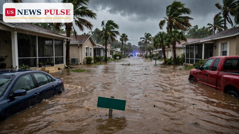
Another round of Florida flooding is bearing down on the state's flood-weary Space Coast. The National Weather Service's Weather Prediction Center has issued a rare moderate risk of excessive rainfall — Level 3 of 4 — for Florida's east-central coast, from Melbourne to Titusville, in effect from 8 a.m. Wednesday through early Thursday. It is only the second such November warning for Florida since 2016, with the St. Johns River already above major flood stage.
Key Points
- The Weather Prediction Center issued a rare moderate risk for Florida's east-central coast, in effect Wednesday morning through early Thursday.
- A flood watch covers almost the entire Florida east coast through Friday evening, with 3 to 6 inches forecast and 8 to 12 inches or more in places.
- The St. Johns River near Cocoa stood at 17.1 feet on Tuesday, above major flood stage, and should reach 17.2 feet by Friday.
- Rain could fall at 2 to 3 inches per hour; AccuWeather puts the heaviest-rain risk as high as 24 inches.
- The new rain falls on ground still saturated from the November 1-2 storm, when more than 20 inches fell in under 24 hours.
What Happened
The warning escalated on Tuesday, November 17. The Weather Prediction Center first issued the moderate risk for Melbourne to Titusville for Wednesday morning through early Thursday, then raised it for more days and areas, including Melbourne through Jacksonville, as models showed heavy rain centred near St. Augustine by Friday, November 20. Flood warnings cover the entire east coast, and a 2 p.m. update warned of flash and urban flooding along the I-95 corridor from St. Augustine to Palm Beach through the weekend.
Emergency managers say flash flooding is expected along the east coast and may lead to more river flooding along the St. Johns. A flood warning stayed in effect until further notice west of Cocoa, where the river is in major flood stage, and a separate warning near Astor for Lake and Volusia counties. The weather service gives a medium chance of 4 to 8 inches along east central Florida this week, with 8 to 12 inches or more on the coast.
Background: A Coast Still Waterlogged
What makes this round so dangerous is what came before it. In early November, a storm dumped more than 20 inches of rain in under 24 hours south of U.S. 192, a once-in-a-thousand-years event, local officials said. Malabar recorded 24.5 inches and Palm Bay 22 inches. It closed all Brevard County public schools on November 2, prompted about 160 rescues, and left some Palm Bay homes in up to five feet of water. Governor Ron DeSantis later expanded the state emergency to 14 counties. Our earlier coverage: Brevard flooding closes Florida schools and DeSantis expands flood emergency to 14 counties.
The river never fell back. The St. Johns near Cocoa stood at 17.1 feet on Tuesday morning and should reach 17.2 feet by 1 a.m. Friday; its record is 17.6 feet, set in October 1953. The centre upgraded the risk partly because the area was inundated earlier this month and its watersheds are still full.
Florida Flooding Risk: Why This Alert Is So Rare
A moderate risk, the third-highest level on the centre's four-tier scale, means at least a 40 percent chance of flash flooding within 25 miles of any given point. Meteorologist Ashton Robinson Cook said it is only the second such November warning since 2016; the first was during the rains of November 1 to 3. "It's kind of rare to have a moderate risk in November and rare outside of a tropical system," Cook said. "But it's a little unprecedented to have this kind of a system with abnormally moist conditions and a storm track probably influenced by El Niño."
Water managers said 2 inches or more of rain in a single November day is extremely rare, with only six such days since 1991 — yet some areas could see that much in a single burst this week. High-end amounts, with a 1-in-10 chance, run to 6 to 8 inches near Melbourne and 4 to 6 inches from Daytona Beach to Fort Pierce and Stuart through Thursday. Forecasters caution that confidence in exact totals is low: showers could stall over the same areas, pushing totals sharply higher in narrow bands.
Reactions and Warnings
The Florida Division of Emergency Management urged residents in flood-prone areas to prepare now: use sandbags, move vehicles and valuables to higher ground, and secure outdoor items. Sandbag help is available through county emergency management offices at FloridaDisaster.org/Counties. Brevard County opened three distribution sites on Tuesday, New Smyrna Beach offered up to 15 sandbags per resident and Port Orange set a limit of 10 per vehicle.
Water managers say they are ready, with pumps at hand. The South Florida Water Management District is readying its canals for more water, and West Palm Beach extended its local state of emergency through November 22. Weather Channel meteorologist Jim Cantore flew in to broadcast from Melbourne. National Weather Service meteorologist Chris Fisher said: "Rainfall amounts are all over the place. On the low end it's 1 to 3 inches over three days but some isolated areas could get much higher amounts if we get training storms just streaming off the coast."
Why It Matters
At 17.2 feet, water from the St. Johns River can enter homes in west Cocoa and Rockledge already flooded this past week. Most at risk are Silver Pines in Rockledge, the Shakespeare area of Cocoa, the Lake Washington area of Melbourne and Lone Cabbage Fish Camp. With the ground saturated, rain that would normally soak away will run off, turning streets into streams. Flash flooding along the I-95 corridor could strand drivers, and some schools hit hard earlier this month were already planning possible closures.
What Happens Next
The heaviest rain is expected from Wednesday morning through Thursday, with more rounds possible into Friday. The flood watch runs through Friday evening, and the river is forecast to keep rising into Friday morning. Residents should watch National Weather Service updates, keep sandbags and supplies ready, and never drive through flooded roads or around barricades.
Frequently Asked Questions
What does a moderate flood risk mean?
Level 3 of 4: at least a 40 percent chance of flash flooding within 25 miles of any given point.
How much rain is expected this week?
Totals of 3 to 6 inches are expected widely, with a medium chance of 4 to 8 inches in east central Florida. AccuWeather puts the heaviest risk as high as 24 inches.
Which areas are most at risk?
The Melbourne to Titusville stretch, the I-95 corridor from St. Augustine to Palm Beach, and St. Johns River communities near Cocoa and Rockledge.
Is the St. Johns River flooding?
Yes. The river near Cocoa stood at 17.1 feet on Tuesday, above major flood stage, and should reach 17.2 feet by Friday.
How does this compare to the early November storm?
That storm dropped more than 20 inches in under 24 hours in places. This round should bring less rain, but it falls on saturated ground and swollen rivers — hence the rare risk.

The US News Pulse newsroom covers breaking news across the United States and the world, working from wire services, official statements and on-the-record sources. Every story is reviewed against our editorial standards before publication. Corrections and tips: info@usnewspulse.com
About our newsroomLeave a Comment